How Google’s Coolest Mapping Technology Changed Over Last 28 Years
How Google’s Coolest Mapping Technology Changed Over Last 28 Years. Google Earth’s time-lapse tool shows you 28 years of change in a few seconds. It captures how much our world has changed. The tool is called Google Earth Engine. The technology collects from the US geological survey’s landsat satellite.
How Google’s Coolest Mapping Technology Changed Over Last 28 Years
Also Read: Google Maps Introduces its “Add a Stop” Feature to iOS Users
Google Earth Engine is an online environment monitoring platform that makes accessible to the whole world a vibrant digital model of our planet that is updated every day. It stocks petabytes of satellite data and permits high-performance tools to evaluate and understand this information that can then be pictured on a map.
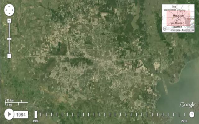
This tool creates a time-lapse from 1984-2012 of any place on Earth. You can also look at changes in locations like man-made islands in Dubai or dwindling glaciers in Alaska.
The free technology is available online or as an API. Researchers are and have been using this technology to analyze the changing world. They trace environmental and population changes on Earth.
Lets have a look at the changes:
Also Read: The Case of Google’s Attempt to Digitally Map the Disputed Regions of the World
PTA Taxes Portal
Find PTA Taxes on All Phones on a Single Page using the PhoneWorld PTA Taxes Portal
Explore NowFollow us on Google News!