Weather Forecasts become more Reliable by U.S. Satellite GOES R
As our technological advancement is consistently gearing towards a more predictable future, the weather remains an important variable that needs to be disclosed accurately. All our day-to-day planning makes use of the available data. It becomes imperative that the weather forecasts become more reliable.
Weather Forecasts become more Reliable by U.S. Satellite GOES R
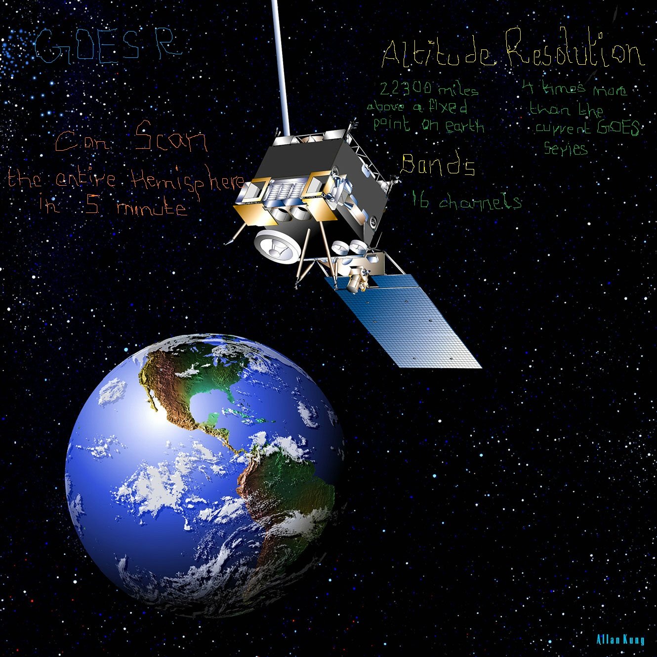
On Saturday 19 November the National Oceanic and Atmospheric Administration’s (NOAA)most reliable and accurate weather satellite, GOES R is scheduled to be launched to space. GOES-R is designed in a way that it can improve forecasts for severe weather events, from hurricanes to tornadoes and solar storms.
Amazingly, GOES R can accurately scan the entire hemisphere in 5 minutes.
Promptly, GOES R can update the weather forecast every 30 seconds.
Worlds most advanced digital camera
According to meteorologists, this satellite GOES R will revolutionize how the weather is forecasted. It is augmented with;
- GOES R will enable scientists to encounter constantly changing weather conditions, by allowing the spacecraft to take pictures every 30 seconds
- the Global Lightning Mapper–tracking all sorts of lightning hazards
- the world’s most advanced digital weather camera named Advanced Baseline Imager gives an image with a resolution of pixels four times bigger than any of the satellites previously used by NOAA.
Also read: 8 Tech Predictions from Qualcomm’s Chairman Paul Jacobs
More Detailed Weather
The satellite GOES R will also project forecasters with more detailed information like;
- 16 channels, or “bands” beamed back to Earth, compared to the present satellite that captures 5 bands.
- meteorologists will be aware of the atmosphere’s volcanic ash and dust availability.
- how much water vapor is in the air.
- other variables like a snowstorm or a thunderstorm.
PTA Taxes Portal
Find PTA Taxes on All Phones on a Single Page using the PhoneWorld PTA Taxes Portal
Explore NowFollow us on Google News!