Now Explore the International Space Station with Google Maps Street View
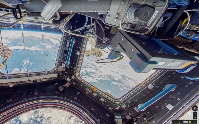
In a recent blog post, Google announced that you can now explore the International Space Station with Google Maps Street View. Instead of using 360-degree camera car up there to capture the imagery, Google tapped the services of European Space Agency (ESA) Astronaut Thomas Pesquet, who photographed the station during a six-month stint.
Now Explore the International Space Station with Google Maps Street View
Also See: ECP Links 70,000 Polling Stations to Google Maps
Google’s Street View team worked with NASA and the Marshall Space Flight Center and took photos using DSLR camera and equipment already on the ISS, while in zero-gravity. Pesquet then beamed the stills he captured down to Earth so that Google could stitch them together to make the 360-degree panoramic images now seen in Google Maps.
ISS Street View offers a close-up look at the 15 connected modules that make up the inside of the station, letting you poke around the place at your leisure. It also provides clickable nodes throughout that you can tap to access more information about what you’re looking at.
So Move to the Google Maps and give it a try
Also Check: You Can Now Check Parking Availability Using Google Maps
Source: Android Authority
PTA Taxes Portal
Find PTA Taxes on All Phones on a Single Page using the PhoneWorld PTA Taxes Portal
Explore NowFollow us on Google News!